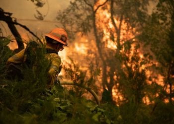
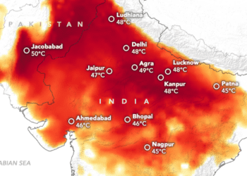
Extreme weather events propelled drastically partly by climate change alter the disaster risk landscape across Latin America. Recently, the entire city of Acapulco in Guerrero, Mexico, was devastated by Hurricane Otis, a rapidly intensifying storm propelled by warming ocean waters. On October 24, over 24 hours, the hurricane experienced explosive intensification, going from a category one to a category five when it landed at 1:30 am. Authorities had minimal to no time to organize a response. Winds reached speeds of 270 kilometers per hour, leaving 52 dead and 32 missing, along with at least $10 billion-plus US dollars in property damage.
In this context, rapid data collaboratives linking public sector, non-governmental, multilateral, and private sector actors into effective emergency decision support frameworks have become more vital than ever before. How can we bring data to bear on the decisions that need to be made during disasters and recovery, and more importantly, how can we scale up these collaborations rapidly when the need emerges overnight, as we saw in Mexico?
According to Dr. Stefaan Verhulst, the NYU GovLab, and the DataTank, the new data landscape brought about by the increasing use of digital tools and data (“Digitalization” and “Datafication”) calls for new models of collaboration that can address mismatches in supply and demand where data is often available but not always accessible or usable. Since 2015, Stefaan has been leading this field of innovation with some critical insights on the linkage between analytic results and the social structure for generating practical analysis: to align the supply of data with demand, for instance, the demand side needs to start asking more explicit questions that data providers can understand. The 100 Questions Initiative (Resources section) seeks to create domain-specific questions to orient data collaboratives. Dr. Verhulst invites the disaster response and humanitarian communities to start here. What are the key questions that, if answered, could transform how we engage with disaster response?
Xavier Moya from the United Nations Development Program (UNDP) echoes this invitation. He assures that straightforward questions are essential to identify suitable stakeholders. Once identified, it becomes an exercise of generating trust around the collaboration and systematizing roles and processes (see resource section for a guidebook on designing data collaborations). This is how over a dozen organizations, including UNDP, have come together as a data collaborative to address reconstruction efforts after Hurricane Otis.
Humanitarian OpenStreetMap Team (HOTOSM), also part of the Hurricane Otis data collaborative, has developed tools and methodologies to map damage in Acapulco through citizen science by systematizing the articulation of manual processes with state-of-the-art technology as Celine Jacquin (HOTOSM) told us. According to Juan Flores from the Centro Estatal de Información Estadística y Geográfica del Estado de Guerrero (CESIEG) these mapping efforts have been essential to guide the reconstruction efforts, which have resulted in the first risk management map of the region, hosted in a geography platform developed jointly with the Secretary of Planning and Regional Development of the state of Guerrero. As this collaboration continues, Juan Flores asks the community to contact him If you have helpful geospatial layers that could help complement the tool.
Resources
- (The GovLab) Data Stewards: What professionals are needed to create public value through cross-sector data collaboration?
- (The GovLab) 100 Questions Initiative: What questions could be transformative if answered?
- (The GovLab) Facilitating Data Flows through Data Collaboratives: A Practical Guide to Designing Valuable, Accessible, and Responsible Data Collaboratives
- (HOTOSM) Learn to Map: Manuals and guides on Open Source mapping: