Updated: Monday, August 21; 2:24 PM ET

(Photo by Mario Tama/Getty Images)
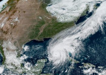
On Sunday, August 20th, Tropical Storm Hilary made landfall on the Baja California peninsula of Mexico, causing widespread power outages and destruction to transportation networks.
The storm subsequently swept over Southern California, marking a historical moment as the first tropical storm to impact the region in 84 years. Concurrently, a 5.1-magnitude earthquake struck Southern California; however, no significant damage was reported by residents and local authorities.
The Chief of the Los Angeles Fire Department confirmed that as of today, there have been no substantial injury reports attributable to the storm. In anticipation of Hurricane Hilary’s arrival, California Governor Gavin Newsom declared a state of emergency on Saturday, with flash flood warnings effective until early Monday.
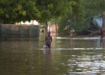
The greatest concerns across the area focused on exceptionally high amounts of rainfall dropping on desert communities that rarely or never see this type of tropical storm activity.
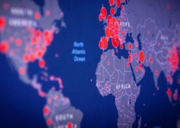
CrisisReady is generating and disseminating periodic situation reports in the wake of the storm. These reports highlight shifts in population densities indicating displacement dynamics, information on healthcare infrastructure, and baseline community vulnerabilities to pinpoint areas most susceptible to disaster impacts.
Data Updates
CrisisReady data reports can also be found on ReliefWeb.
Sunday, August 20, 2023
Southern California | 19:00 EDT (7:00 p.m. local time)
This report provides information on local healthcare infrastructure as well as baseline population vulnerabilities and density changes in Southern California registered on Sunday, August 20 at 19:00 EDT (7:00 p.m. local time).
Key Observations
General Updates & Community Demographics:
- In desert communities around Palm Springs, most areas showed:
- High population density rates.
- Low mobility rates compared to the 90-day pre-crisis baseline, suggesting limited travel due to either personal choice or transportation disruptions from flooding.
- Communities near Palm Springs have an older population than the state average.
- Areas like Desert Palms and Indian Wells have between 56% and 83% of their residents aged 65 or older.
Decreases in Population Densities:
- Communities with notable population declines, potentially due to voluntary evacuations, include:
- Palm Springs: -4% (a decrease of 502 individuals).
- Idyllwild, Cabazon, and Big Bear Lake: Decreases ranging from 18% to 31%.
*Please note: The data sourced from Facebook users with location services covers 16% of the total population. Some regions have coverage exceeding 25%.