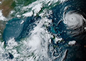
Hurricane Ian was a Category 4 Atlantic hurricane that affected Caribbean countries, including Jamaica, Cuba, and the Cayman Islands, and caused mass destruction in southeastern U.S. states, namely Florida and South Carolina. Local officials report that the hurricane caused at least 137 fatalities, including 5 people in Cuba, 126 in Florida, 5 in North Carolina, and 1 in Virginia as of October 6, 2022. This U.S. death toll makes Hurricane Ian at least the 24th deadliest hurricane in the country’s history.
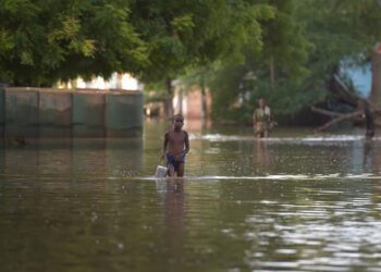
Hurricane Ian caused catastrophic damage with losses estimated between $28–63 billion USD. Damage was mostly caused by floods. Millions were left without power as the storm advanced northward, and several communities were displaced due to the widespread environmental and infrastructural damage caused by the hurricane.

Photo Credit: Sean Rayford/Getty Images

Photo Credit: The Associated Press 2022.
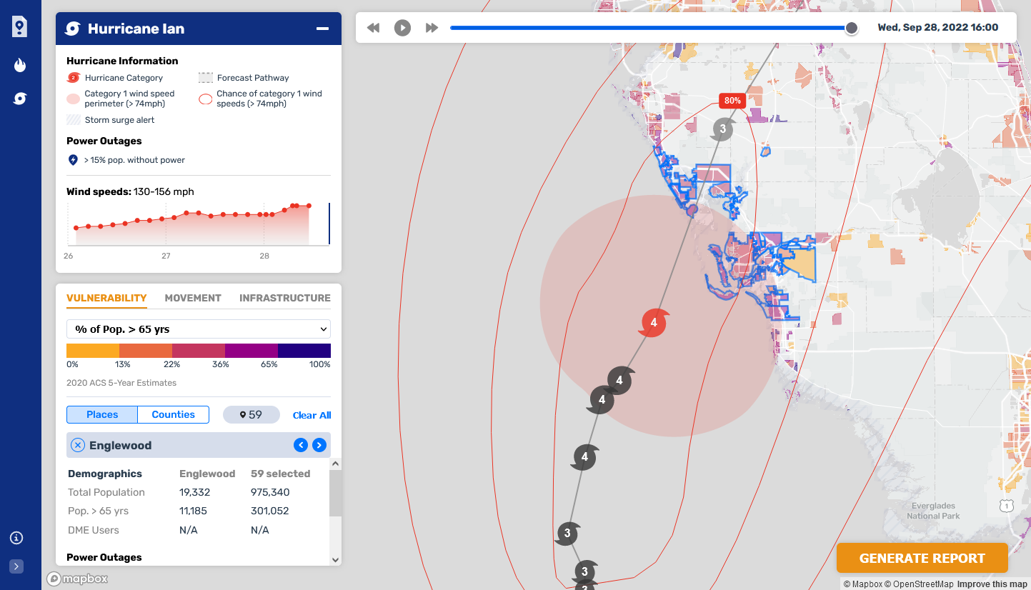
Below are periodic reports generated by CrisisReady that highlight community vulnerabilities, movement, population densities, power outages, and infrastructural capacities of the regions most affected by Ian. The reports show data collected before and after the hurricane made landfall. Particular areas of interest were in southwestern Florida, where destruction was the most severe. Other areas of interest include central Florida and the eastern coast of South Carolina.
Reports
Southwest Florida, United States
4 October, 2022; 1600 EDT
As of October 4, widespread power outages persisted across the entire area of southwest Florida, proximate to the landfall of Hurricane Ian.
Rates of return throughout the affected area are above baseline, except for the most affected counties (i.e. Charlotte and Lee). Even in these counties, however, population densities based on Facebook users have nearly returned to baseline.
Florida, United States
2 October, 2022; 1600 EDT
As of the end of October 2, 2022, counties across Florida that have been most impacted by Hurricane Ian continue to see widespread power outages and reductions in population densities. This report provides updated data on population movement and vulnerabilities.
Southwest Florida, United States (American Community Survey Data)
1 October, 2022; 1600 EDT
This report provides a granular view of population movement and vulnerability dynamics for areas along the southwest coast of Florida impacted by Hurricane Ian.
Southwest Florida, United States
1 October, 2022; 1600 EDT
This report summarizes population movement patterns and vulnerability indicators for the coastal southwest of Florida in the aftermath of Hurricane Ian’s landfall in the state.
East Coast South Carolina, United States
1 October, 2022; 1600 EDT
This report summarizes population movement patterns and vulnerability indicators for the East Coast of South Carolina after Hurricane Ian made landfall in the state.
Charleston Region, South Carolina, United States
30 September, 2022; 1600 EDT
Hurricane Ian made landfall in Georgetown, South Carolina on Friday, September 30 around 2:00 PM EDT with winds up to 85 mph, making it a Category 1 hurricane.
Age vulnerabilities are relatively significant in this region. The counties in the immediate path of the hurricane range from a low of 14% of the population over the age of 65 to a high of 28%. In some areas, particularly on a number of islands off the Atlantic coast, the proportion grows to 40% or more of the total population. Orangeburg, Williamsburg, and Clarendon Counties are the areas in the hurricane’s path with the highest proportion of people living in poverty, with rates between 21% and 23%.
South Carolina has not yet experienced power outages to any significant degree. However, the recent experience in Florida shows that widespread outages are likely. Rates of users of power-dependent medical equipment are relatively low to in-line with the national average, with the exception of Horry County, which has a rate of DME users roughly 4x the average U.S. county.
Charlotte County, Western Florida, United States (Post-Landfall)
Wednesday, September 28, 2022
This is a specific situation report for Charlotte County, Florida, after Hurricane Ian made landfall on Thursday, September 28 at 1800 EDT. The report shows changes in population density as well as data on community vulnerabilities and power outages.
There was a large decrease in population density by 74% in Charlotte County, suggested from our daily analyses that people continued to evacuate shortly before the hurricane made landfall. According to the American Community Survey (ACS), ~29% of Charlotte County’s population are 65 years of age or older, with a higher percentage of those over 65 in the path of the hurricane and in the coastal areas.
As of September 28, 1800 EDT, there was a significant increase in power outages in the county. Our power data sources are unable to show outages at the place or sub-county level at this time.
Lee County, Western Florida, United States (Post-Landfall)
Wednesday, September 28, 2022
This is a specific situation report for Lee County, Florida, after Hurricane Ian made landfall on Thursday, September 28 at 1800 EDT. The report shows changes in population density as well as data on community vulnerabilities and power outages.
There was a large decrease in population density by 65% in Lee County, suggested from our daily analyses that people continued to evacuate shortly before the hurricane made landfall. According to the American Community Survey (ACS), ~29% of Lee County’s population are 65 years of age or older, with a higher percentage of those over 65 in the path of the hurricane and in the coastal areas.
As of September 28, 1800 EDT, there was a significant increase in power outages in the county. Our power data sources are unable to show outages at the place or sub-county level at this time.
Central and Eastern Florida, United States
Wednesday, September 28, 2022
Hurricane Ian passed over the Central and Eastern regions of Florida on Thursday, September 29 at Category 1 strength. Power outages were not prevalent throughout this region, with only modest outages reported in Volusia, Brevard, and Orange counties.
Most areas showed population increases, due in part to evacuations ordered in Southwestern Florida, which bore the brunt of the storm. Coastal areas, including Daytona Beach and Cocoa Beach, showed modest declines between 1% and 9%. Areas from Kissimmee to Alafaya showed increases in population between 7% and 10%.
Volusia and Brevard counties have a high percentage of elderly residents at 24%, with over 13,000 users of power-dependent medical devices between the two counties. Orange county has a younger population compared to the other nearby, with only 12% of residents over the age of 65. Given its relatively higher total population, it has roughly the same average number of power-dependent medical device users as Volusia and Brevard.
Charlotte and Lee Counties, Western Florida
Wednesday, September 28, 2022
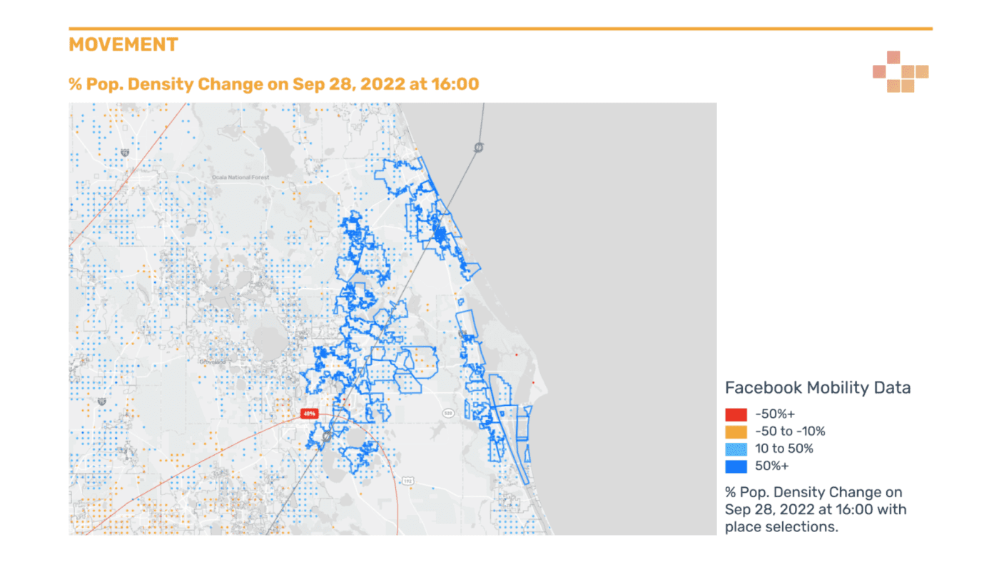
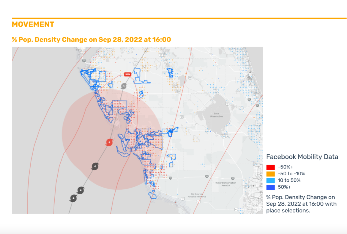
As Hurricane Ian made landfall near the counties of Charlotte and Lee, widespread reductions in population density could be detected throughout the area.
Charlotte and Lee saw population reductions between 65% and 74%. These reductions took place a day before the hurricane made landfall. Using the Facebook data alone as a signal, we can detect more than 100,00 people remaining in the heavily-flooded coastal counties of Charlotte, Lee, Sarasota, and DeSoto.
On September 28, no town or municipality registered increasing population densities. On the low end, areas such as Sebring and Lakewood Ranch showed declines between 1% and 22%. On the high end, areas such as Cape Coral and Port Charlotte showed declines of 74% or more.
Severe power outages took place in Manatee, Collier, Lee, and Sarasota counties, affecting 100% of customers. Cumulatively, those counties contain nearly 17,000 people registered as using power dependent medical devices.
Western Florida, United States
Tuesday, September 27, 2022
This report summarizes vulnerability and population mobility data for the regions south of Tampa Bay, Florida. Charlotte, Sarasota, Lee, and DeSoto Counties are predicted to be where Hurricane Ian will first make landfall late Wednesday, September 28, or early Thursday, September 29.
Interpretation: The population, particularly in Charlotte County, tends to be disproportionately older than other counties in the area. However, Sarasota has a higher proportion of patients with power-dependent medical devices.
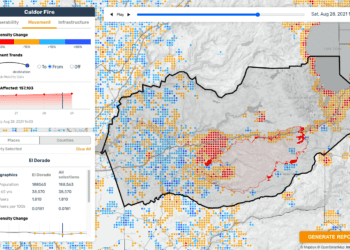
Although relatively significant decreasing movement trends can be detected, especially in smaller coastal communities, some areas are showing increasing population trends over the 26th and 17th. A number of places in Charlotte County in particular are still showing a large number of people who have not evacuated.