Disaster Updates
Updated as of Wednesday, January 15, 2025, at 5:00 p.m. PT
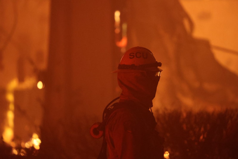
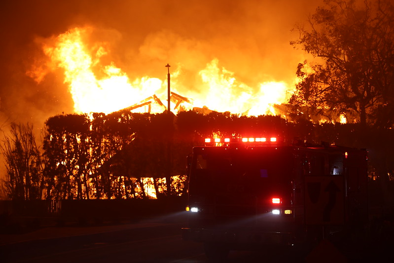
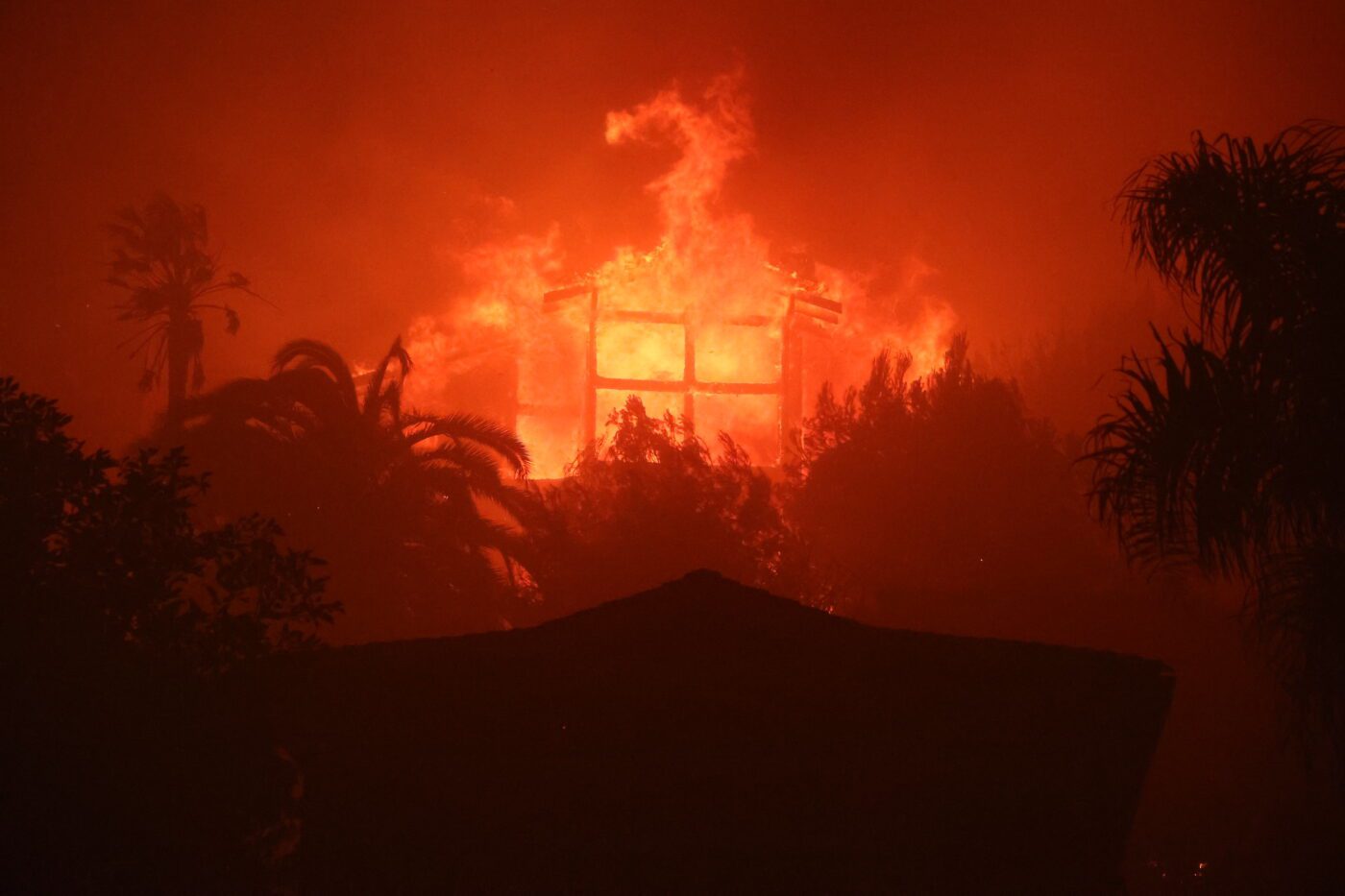
Palisades Fire
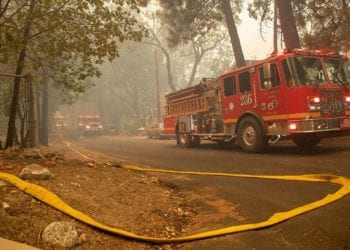
As of Wednesday, January 15, at 4:12 p.m. PT, the Palisades Fire has burned 23,713 acres since igniting last week. The fire perimeter has expanded by 16% since the last report on Friday, January 10.
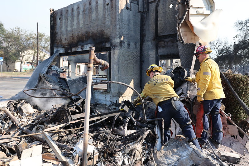
Containment has increased to 19% as of 7:20 a.m. Wednesday, up from 17% on Tuesday morning. According to an incident report from CalFire published Wednesday afternoon, the fire has destroyed 2,191 structures and damaged an additional 397. Tragically, there have been nine confirmed fatalities linked to the fire, as reported by the Los Angeles Times.
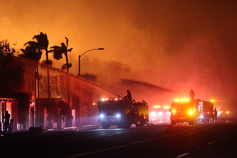
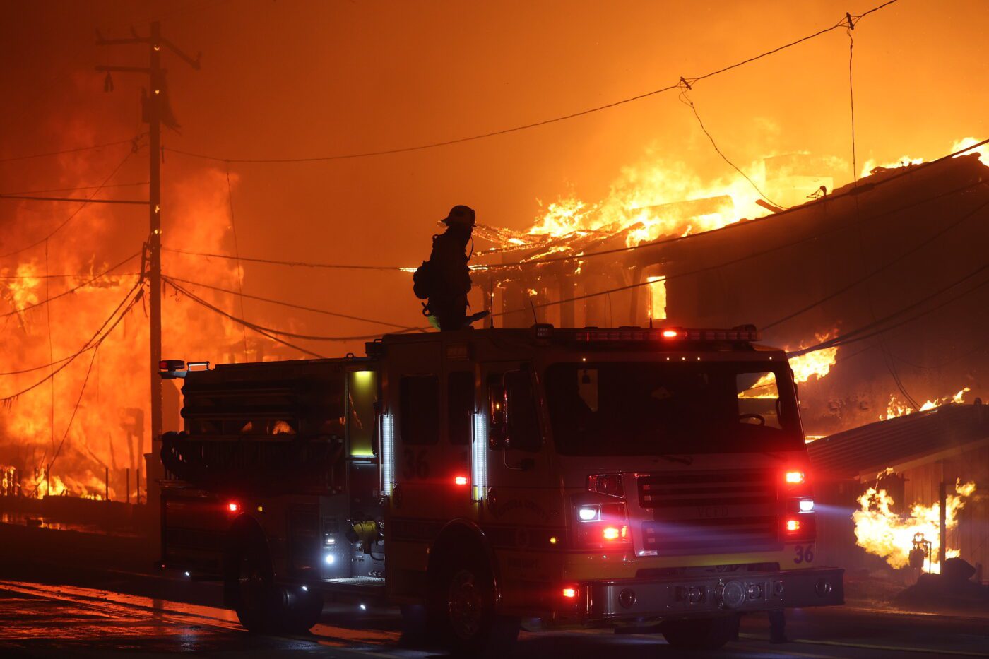
Eaton Fire
As of Tuesday, January 14, mandatory evacuation orders remained in effect for Pacific Palisades, portions of Topanga, and parts of Malibu. The evacuation zone extended approximately from Las Virgenes Road in the west to the 405 Freeway in the east, and from the coastline in the south to Calabasas and the Encino Reservoir in the north. For more information on closures, evacuations, and shelters, refer to official updates.
Meanwhile, the Eaton Fire has burned a total of 14,117 acres and is now 45% contained, an increase from 35% containment earlier on Tuesday. The fire perimeter has grown by 3.12% since the last update on Friday, January 10. According to a CalFire incident report, 4,627 structures have been destroyed and 486 have been damaged, with numbers expected to rise. The Los Angeles Times reported 16 confirmed fatalities from the Eaton Fire as of Wednesday afternoon.
Previous Updates
Friday, January 10, 2025
Updated as of Friday, January 10, 2025, at 3:00 p.m. PT
As of Friday at 1:16 p.m. PT, the Palisades Fire in Los Angeles County has grown by 18.59%, increasing from 17,234 acres on Thursday afternoon to 20,438 acres. According to a CalFire Incident Report, 11,471 structures are threatened, with additional damage expected as the fire is only 8% contained. The number of destroyed structures has not yet been reported.
The fire has caused 10 fatalities, with more expected to come as the fires progress, according to The New York Times.
Two more fires have ignited since yesterday. The Kenneth Fire began burning at 3:34 p.m. PT on Thursday, January 9. In addition to this, the Archer Fire ignited today in Granada Hills, a northern neighborhood in Los Angeles’ San Fernando Valley. It is located west of the Hurst Fire, which started earlier this week in nearby Sylmar. Mandatory evacuation orders and warnings were quickly issued for surrounding areas.
Meanwhile, the Eaton Fire, which began on Tuesday evening, January 7, has grown significantly in the past 24 hours. Its size has increased by 29.15%, from 10,600 acres yesterday at 1:34 p.m. PT to 13,690 acres today at 1:25 p.m. PT.
According to a CalFire Incident Report published on Friday afternoon, the Eaton Fire has threatened 39,428 structures and destroyed 5,000. Containment remains at just 3% as of 1:25 p.m. PT.
The report also states that firefighters responded to multiple service calls and extinguished hotspots around structures on Thursday night. Aircraft were deployed for water-dropping missions along the northeast perimeter near Chantry Flats, where fire growth was observed.
The report indicates that the focus today remains on protecting structures and constructing fire lines to increase containment on the East, North, and West flanks.
Thursday, January 9, 2025
Updated as of Thursday, January 9, 2025, at 3:00 p.m. PT
As of Thursday afternoon (2:20 p.m. PT) on January 9, 2025 — two days after the Palisades Fire ignited in Pacific Palisades and other communities on the western side of Los Angeles — the fire has burned 17,234 acres, according to the latest CalFire Situation Report. Despite strenuous efforts by fire departments and emergency response teams, the wildfire is still 0% contained. The Situation Report also estimates that 13,306 structures have been threatened by the fire.
Shortly after the Palisades Fire began this past Tuesday, four additional fires swept across nearby areas in the greater Los Angeles area, stretching from the coastal foothills of the Santa Monica Mountains to the San Fernando Valley and the San Gabriel Mountain foothills, a region encompassing a mix of suburban, urban, and natural landscapes.
These fires included the Eaton and Bert Fires in Pasadena, the Woodley Fire in northwestern Los Angeles’s Sepulveda Basin, and the Hurst Fire in Sylmar.
While the Palisades Fire remains the largest out of the five, the Eaton Fire has caused almost the same amount of destruction. As of Thursday afternoon (2:00 p.m. PT), January 9, CalFire reports that the Eaton Fire has burned 10,600 acres in the Altadena area of Los Angeles County. The fire, exacerbated by the Santa Ana winds, has destroyed hundreds of homes, uprooted thousands of civilians, and has caused two recorded fatalities thus far.
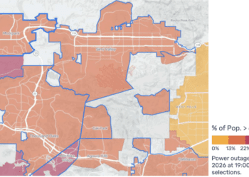
All five of the fires have also caused critical disruptions in power across Los Angeles County. As of Thursday morning, SCE reported the total number of customers in the county without power is 327,654.
Wednesday, January 8, 2025
On Tuesday, January 7, 2025, a brush fire broke out in Pacific Palisades, California, a neighborhood located in the Western side of Los Angeles, between the Santa Monica Mountains and the Pacific Ocean. The Los Angeles Fire Department stated that the Palisades Fire began at 10:30 a.m. PT on Tuesday morning. Winds were reported to have reached between 40 and 50 mph, causing the fire to spread quickly across 200 acres that morning.
By Tuesday night, two more fires — the Eaton fire and Bert fire — broke out, the first in the hills above Altadena near Eaton Canyon in Pasadena and the second in the Eastern parts of Pasadena, near San Gabriel. These two fires prompted even more evacuation orders in the area and increased response from firefighters and emergency response teams.
By Wednesday morning at 8:58 a.m. PT, the Woodley Fire began to burn in Sepulveda Basin, a large urban park located in northwest Los Angeles. The Hurst Fire broke out the same day around 1:20 p.m. PT in Sylmar, a suburb in the San Fernando Valley and the northernmost neighborhood within the city of Los Angeles.
The five fires came in the wake of extreme and unpredictable winds — the worst Southern California has seen since 2011. As of Wednesday, January 8, at 4:00 p.m. PT, more than 1,100 builds have been burned and at least 5 people have been killed by the fires.
Reports
LATEST REPORT
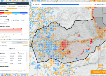
January 14, 2025: Los Angeles Fires Situation Report – Population Density Changes & Community Vulnerabilities
Publication Date: January 14, 2025
Location: Los Angeles County, California
Time: 19:00 EST (16:00 PST\4:00 PM Local Time)
This ReadyMapper Situation Report provides data on the following:
- Changes in Population Densities
- Measured as the percentage change in the number of Meta application users in a specific area during the analysis period, compared to baseline levels recorded 90 days before the fire began.
- Baseline Community Vulnerabilities
- Total number and percentage of the population aged 65 and older.
- Percentage of the population below the poverty level.
- Total number and percentage of the population without power.
- Number of Durable Medical Equipment (DME) users.
Key Observations
Decreases in Population Densities
- Persistent low population densities relative to the 90-day pre-crisis baseline in the following zones:
- Altadena: -49%
- Topanga (Pacific Palisades): -44%
- Malibu: -36%
Increases in Population Densities
- Agoura Hills: Population densities have been at least 10% above baseline for the past four days following initial decreases after the fires.
- La Crescenta-Montrose: After large evacuations near the Eaton Fire, population levels have been above baseline since January 11th.
Other Disaster Updates:
- The Palisades and Eaton Fires, which ignited on January 7th, have burned nearly 40,000 acres of highly populated areas and neighborhoods in Los Angeles.
- 25 fatalities have been reported.
- As of the afternoon of January 14th, most neighborhoods near fire-affected areas are returning to baseline population levels, except for the persistent decreases noted above.
- Facebook population data is considered highly representative of the overall population in Los Angeles, with a strong correlation (R² = 0.9) at the ACS Place level.
January 9, 2025: Los Angeles Fires (Palisades, Eaton, Kenneth, Hurst) – Population Density Changes
Publication Date: January 9, 2025
Location: Los Angeles County, California
Time: 19:00 EST (16:00 PST\4:00 PM Local Time)
This situation report, based on data from Meta’s “Data for Good” initiative, highlights changes in population densities recorded on January 9, 2025, at 19:00 EST (4:00 PM PT) in Los Angeles County, focusing on areas most impacted by the Palisades, Eaton, Kenneth, and Hurst Fires.
The report includes a map illustrating widespread displacement, significant changes in population mobility patterns, and primary evacuation pathways as of the afternoon of January 9th.
Key Observations
Decreases in Population Densities
- Significant declines in population densities have been observed in mandatory evacuation areas, with decreases of up to 70%, compared to the 90-day pre-crisis baseline.
- Population declines are concentrated in regions directly impacted by fires and under evacuation orders.
Increases in Population Densities
- Population movements have been detected toward safer areas outside of evacuation zones, following primary pathways highlighted on the map.
- Increased densities are likely occurring in neighboring cities and regions where evacuees have relocated, though specific areas are not detailed in this summary.
Other Disaster Updates:
- Multiple fires have burned over 25,000 acres across the Los Angeles region since the Palisades Fire began on January 7th.
- At least 10 fatalities have been reported, and 180,000 people are under evacuation orders.
- The fires have destroyed at least 10,000 structures, further contributing to the crisis.
January 8, 2025: Eaton Fire | ReadyMapper Situation Report – Population Density Changes, Vulnerabilities, and Healthcare Infrastructure
Publication Date: January 8, 2025
Location: Pasadena, California
Time: 19:00 EST (16:00 PST\4:00 PM Local Time)
This ReadyMapper Situation Report provides data on the following:
- Changes in Population Densities
- Measured as the percentage change in the number of Meta application users in a specific area during the analysis period, compared to baseline levels recorded 90 days before the fire began.
- Baseline Community Vulnerabilities
- Total number and percentage of the population aged 65 and older.
- Percentage of the population below the poverty level.
- Total number and percentage of the population without power.
- Number of Durable Medical Equipment (DME) users.
- Local Healthcare Infrastructure:
- Total number of healthcare facilities, including hospitals, long-term care facilities, and outpatient facilities, in the analyzed regions.
Changes in population densities, which provide signals into population displacement dynamics, were calculated using data from Meta’s Data for Good program, comparing active Facebook user numbers during the analysis period to baseline levels recorded 90 days before the hurricane.
Key Observations
Decreases in Population Densities
- Significant population decreases were observed in areas under mandatory evacuation orders:
- Altadena: -70%
- La Cañada Flintridge: -65%
- Sierra Madre: -52%
- La Crescenta-Montrose: -39%
- Smaller but notable declines occurred in evacuation warning zones:
- Bradbury: -27%
- Pasadena: -23%
- Monrovia: -21%
- Duarte: -18%
Increases in Population Densities
- Population movement trends indicate migration away from the evacuation zones; specific increases in surrounding areas are not detailed in the report but are implied by declines in affected regions.
Community Vulnerabilities
- Altadena and Sierra Madre are identified as highly socially vulnerable:
- Populations aged 65 and older comprise 20% of the total population.
- Both areas are experiencing widespread power outages.
Other Disaster Updates:
- The Eaton Fire has burned 10,600 acres as of January 9 and remains 0% contained. Evacuation orders and warnings extend from La Crescenta in the east to Bradbury in the west.
- A strong correlation exists between Facebook user data and U.S. Census population data in the region (R² = 0.9), though notable outliers include:
- Glendale: Higher than expected proportion of Facebook users.
- Burbank: Lower than expected proportion of Facebook users.
- More details on the incident can be found at CalFire’s Eaton Fire page.
January 7, 2025: Eaton Fire | Population Density Changes in Pasadena, California
Publication Date: January 7, 2025
Location: Pasadena, California
Time: 19:00 EST (16:00 PST\4:00 PM Local Time)
This situation report details the changes in population densities recorded on January 7, 2025, in Pasadena and nearby areas impacted by the Eaton Fire.
The percentage increases and decreases in this report were calculated using data from Meta’s Data for Good program, comparing active Facebook user numbers during the analysis period to baseline levels recorded 90 days before the hurricane.
Key Observations
Decreases in Population Densities
- Population in areas under mandatory and voluntary evacuation zones decreased by nearly 5% by the evening of January 7, 2025.
- This decrease is based on comparisons with the 90-day pre-event baseline provided by Data for Good at Meta.
Increases in Population Densities
- Data signals that displaced populations primarily moved south and southeast toward Glendale and Los Angeles, leading to a localized increase in population densities in these areas.
Other Disaster Updates:
- The Eaton Fire began at 6:18 p.m. on January 7, 2025, in Eaton Canyon Natural Area, located north of Pasadena.
- As of the afternoon of January 8, the fire had burned 10,600 acres and was identified as high-risk for rapid spread due to high winds and long-term drought conditions.
- Emergency services continue to monitor the fire closely, with CalFIRE reporting it remains uncontained.
January 7, 2025: Palisades Fire | Population Density Changes in Western Los Angeles, California
Publication Date: January 7, 2025
Location: Western Los Angeles, California (Pacific Palisades, Santa Monica, Malibu)
Time: 19:00 EST (16:00 PST\4:00 PM Local Time)
This situation report provides information on changes in population densities in the areas of Southern California that have most impacted by the Palisades Fire, namely Pacific Palisades, Santa Monica, and Malibu.
Changes in population densities can reveal evacuation routes and displacement patterns as the Palisades Fire and nearby wildfires continue to spread.
The percentage increases and decreases in this report were calculated using data from Meta’s Data for Good program, comparing active Facebook user numbers during the analysis period to baseline levels recorded 90 days before the hurricane.
Key Observations
Decreases in Population Densities
- Population in the area between Malibu and Santa Monica decreased by 20% by the evening of January 7th, compared to the 90-day pre-event baseline.
- Displacement patterns indicate movement primarily east and north from the affected area.
Increases in Population Densities
- At the time of analysis, population increases were observed east and north of the fire zone, aligning with the primary evacuation directions.
Other Disaster Updates:
- The Palisades Fire began at 10:30 AM on January 7th, 2025, near Topanga State Park, west of Los Angeles.
- As of the morning of January 8th, the fire has burned 2,925 acres.
- The fire remains at high risk of rapid spread due to high winds and long-term drought conditions, according to CalFIRE.
Photos


Header image source: CalFire